Uncommissioned work
May 2015 - present
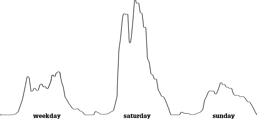
Mobility changes: cities grow and travel in the cities will increase. At the same time, with new trends such as flexible working, online shopping and the growth of our digital infrastructure, mobility patterns shift and travel seems less necessary. How does mobility change? How will we deal with that in the future?
This research project investigates mobility patterns on different scales: from mobility in buildings to international travel patterns. This could include a distinction in mobility per transportation method, mobility per demographic group or total mobility within a set geographical boundary.
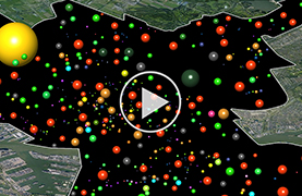
The project focuses on different ways to visualize mobility patterns: from abstract diagrams to displays on realistic geographical maps and from images to interactive models.
Why map mobility? We can gain knowledge from this research and develop design solutions for buildings and cities to deal with increased mobility and changing mobility patterns.
This is an ungoing project. More studies will follow soon.
within the city of Rotterdam, the Netherlands (2013)